By the ArubaTourism.org team · Last updated June 2026
Let’s clear up Aruba’s most common tourist disappointment right away: the Natural Bridge — that giant limestone arch from a thousand vintage postcards — collapsed back in 2005. Every week, someone drives all the way out to the rugged north coast expecting to find it still standing. Here is the good news: the smaller “Baby Bridge” beside it survived, the pounding surf and the haunting Bushiribana gold-mill ruins next door are genuinely spectacular, and the stop is still well worth the trip. This guide covers what is actually there now, how to reach it, and how to make the most of the visit.
This guide is the one I wish I’d had on that first trip. I’ll cover what actually remains, the real story of the collapse, how to get out there without wrecking a rental car, what to see, where the danger spots are, and how to string the bridge together with the other north-coast stops into a half-day loop that feels like the Aruba most people never see.
The short answer: what to know about the Natural Bridge in Aruba
Aruba’s famous Natural Bridge, a coral-limestone arch on the rugged north coast near the Bushiribana Gold Mill ruins, collapsed in September 2005. The site is still free to visit and worth it: the smaller, intact Baby Bridge sits right beside the original’s remains, the surf is spectacular, and there’s a snack bar and gift shop on-site. Plan 30 to 60 minutes, and combine it with nearby ruins and beaches.
Aruba Natural Bridge at a glance
Here’s the quick-reference version before we get into the detail. Prices and hours are what I saw on my last visits and from current local sources in 2026 — treat them as “around” and confirm on the day, because the little gift shop in particular keeps its own schedule.
| Detail | What to expect |
|---|---|
| What it is | Collapsed coral-limestone sea arch (fell 2005) + the intact “Baby Bridge” beside it |
| Where | North (windward) coast, near Bushiribana, on the edge of Andicuri Bay; roughly 12.54°N, 69.96°W |
| Cost | Free to visit the bridge site and Baby Bridge |
| Hours | Open-air site, accessible any time; the on-site gift shop/snack bar keeps daytime hours and often closes on holidays |
| Getting there | ~25-35 min drive from Palm Beach/Oranjestad; last stretch is graded dirt. A 2WD can manage it slowly; an SUV/4×4 is more comfortable |
| Parking | Free dirt lot on-site |
| Facilities | Gift shop, snack/drinks bar in a replica cunucu (country) house, restrooms (small fee, bring coins) |
| Time needed | 30-60 min on its own; half a day if you loop in nearby stops |
| Best for | Photographers, history buffs, road-trippers, cruise-day explorers, families with sure-footed kids |
| Don’t | Climb onto the wet collapsed rubble or wade/swim — the north-shore surf is deadly here |
Want this stop in the context of everything else on the island? It lives in our wider guide to things to do in Aruba, and it pairs naturally with a rental-car day — see getting to and around Aruba for the driving logistics.
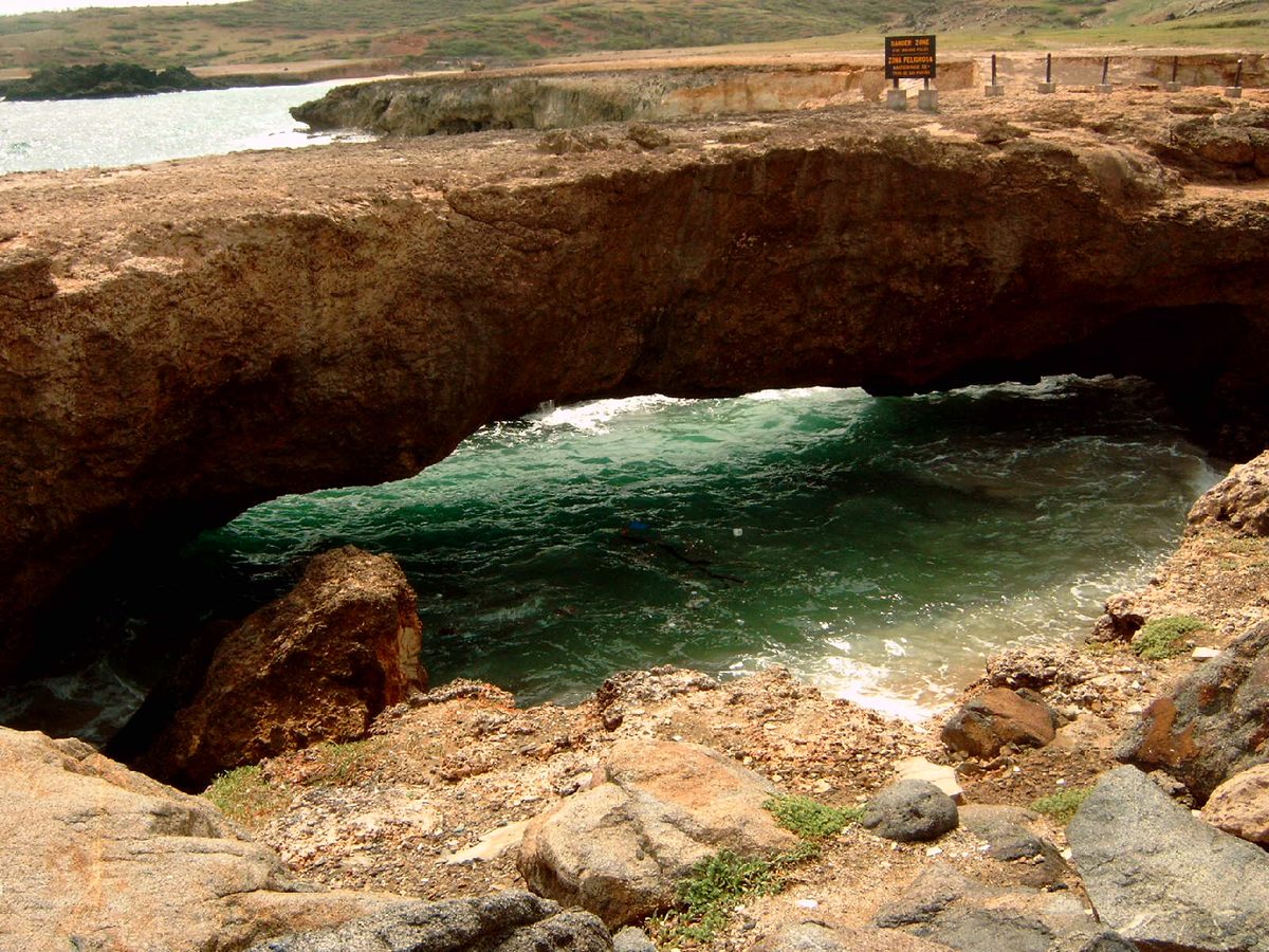
The famous Natural Bridge and its 2005 collapse
For most of the 20th century, the Natural Bridge was the shot from Aruba — the one your grandparents brought home on a slide carousel. It was a free-standing arch of coral limestone, the fossilized remnant of an ancient sea cave whose roof the ocean had hollowed and the rest of which had long since fallen away. By the figures most often cited it stood about 25 feet (7.6 m) above the water and stretched roughly 100 feet (30 m) end to end, which made it one of the largest natural sea bridges of its kind anywhere in the world. People walked across the top of it. Tour buses parked beside it. It was, for decades, the single most photographed natural landmark on the island.
Then, on 2 September 2005, it simply let go. There was no storm, no dramatic trigger that anyone could point to — just the same relentless physics that had built the arch in the first place, finally winning. The Caribbean’s trade winds drive a heavy, ceaseless swell onto this windward shore, and that water had been undercutting the soft limestone for centuries. The span gave way and dropped into the sea, and Aruba woke up to find its postcard icon reduced to a field of broken rock. Locals I’ve talked to still remember exactly where they were when they heard; for a small island, losing the Natural Bridge was a genuine event.
What I find moving about the spot now is that the geology is still happening right in front of you. You’re not looking at a static ruin so much as a snapshot of a slow, ongoing process — the next arch is being quarried out of the cliff by the same waves, somewhere along this coast, right now. That’s part of why I think the site is still very much worth the drive even though the headline attraction is technically gone.
The Baby Bridge: the arch that’s still standing
Here’s the good news nobody puts on the brochures: you can still see a real natural bridge here. A few steps to the side of the original’s rubble stands the Baby Bridge (also called the Baby Natural Bridge or, charmingly, the little sibling of the “Mother Bridge” that fell). It’s a smaller limestone arch, low and stout, carved by exactly the same wave action that built and then destroyed its bigger sibling. On my first visit I almost walked straight past it because I was busy mourning the big one — don’t make that mistake.
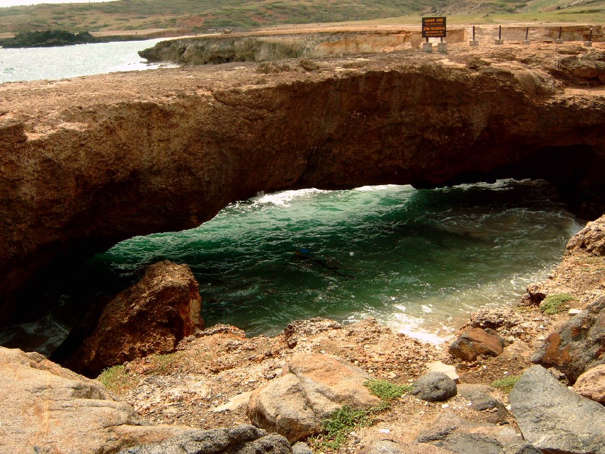
Up close the Baby Bridge is honestly more rewarding than photos suggest. Because it’s at human scale, you can actually study how these things form: the smooth scalloped underside where the water has done its work, the harder bands of rock that resisted longest, the salt crust glittering on top. Stand beside it for a few minutes and the whole story of the coast clicks into place. I’d argue it’s the most educational thirty seconds of geology you’ll get on the island without a guide.
You can walk up to and around the Baby Bridge, and plenty of people pose on or beside it. My honest take: enjoy it, photograph it, but show some restraint about clambering on top. It’s the same brittle, salt-weakened limestone as the arch that collapsed, the rock is often wet and slick, and a fall lands you on stone or in surf that does not forgive. There’s a great picture to be had standing next to it with the spray behind you — you don’t need to be on it.
A genuinely wild stretch of coast
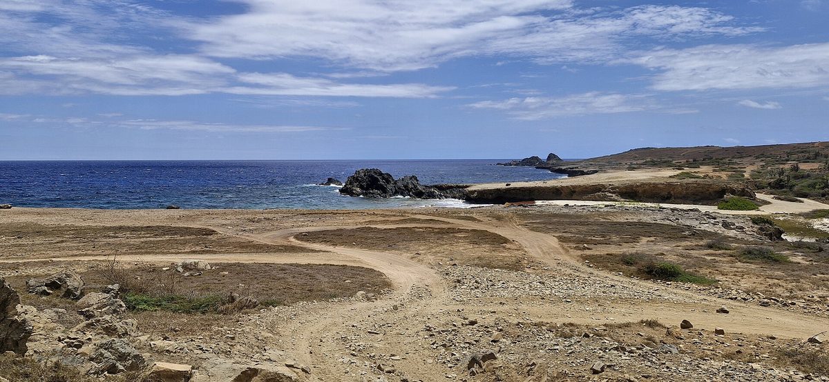
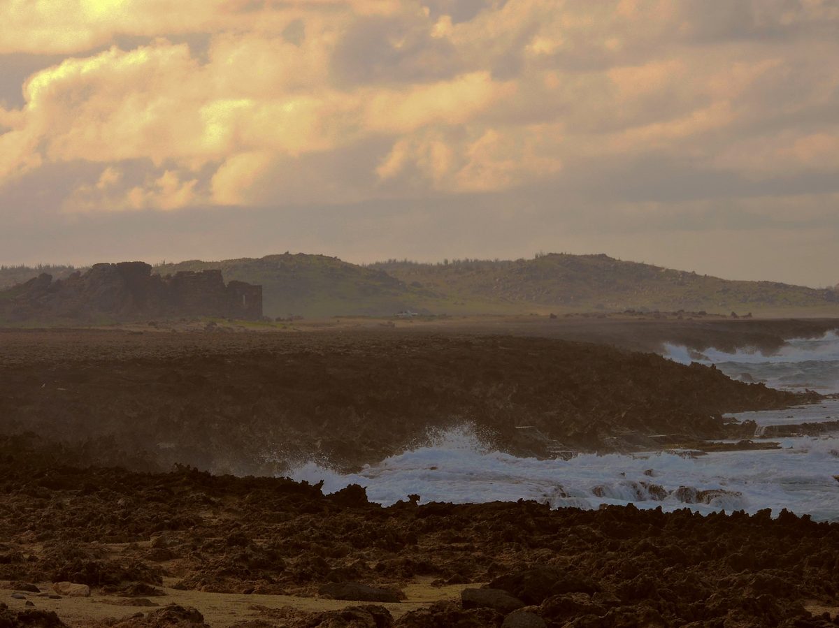
The thing that surprises first-time visitors most isn’t the bridge — it’s how different this side of Aruba feels from the postcard side. The beaches you see in the ads, the calm turquoise of Aruba’s beaches like Eagle and Palm, are all on the sheltered leeward (west) coast. Out here on the windward north shore, the island turns its back to the trade winds and takes the full Atlantic-fed swell on the chin. The water is deep navy and white, not turquoise. The wind is constant. The rock is black and gold and jagged.
That contrast is exactly why I think every itinerary should include at least one north-coast morning. You get divi-divi trees bent permanently sideways by the wind, fields of cactus and aloe, wild donkeys and goats wandering the cunucu (the local word for Aruba’s arid countryside), and waves exploding against the cliffs in a way that makes the whole place feel raw and alive. It’s the Aruba that existed long before the high-rise hotels, and it’s free.
If you look down at the rocks around the bridge site you can read the island’s deep history in the stone. The dark, almost volcanic-looking rock at the base is among the oldest material on Aruba; the pale limestone on top formed later, when this land sat beneath the Caribbean and corals grew on it. People regularly spot fossilized coral — big brain corals, fan corals, even the occasional embedded shell — locked into the rock around the bridges. It’s a quiet reminder that the whole northern shelf of the island was once seafloor.
The Bushiribana Gold Mill ruins next door
If you only budget time for the bridge, you’ll miss what is, for my money, the most atmospheric ruin on Aruba — and it’s a two-minute drive away. The Bushiribana Gold Mill stands on the headland just to the west, a roofless shell of hand-stacked stone walls perched right above the crashing surf. Walk up into it and you can climb a remaining staircase on the southern wall for a sweeping view back along the coast. It looks for all the world like a small fortress, which is exactly what most cruise-day visitors assume it is. It’s something better: a relic of Aruba’s gold rush.
Gold was discovered on Aruba in 1824, the story goes, by a boy named Willem Rasmijn herding sheep near Rooi Fluit. That find kicked off a roughly century-long gold era on this dry little island. The Bushiribana mill itself was built in 1872 by the London-based Aruba Island Gold Mining Company as a smelter to process the ore dug from the surrounding hills. What I love is the engineering logic of the site: they built it out here on the brutally windy coast on purpose, because the same relentless wind that bends the divi-divi trees was harnessed to help power the crushing and processing of the stone.
The mill ran for about a decade and refined a couple of thousand ounces of gold before falling quiet around 1882-1883. A second British outfit, the Aruba Agency Company, reopened operations later that decade, and Bushiribana finally closed for good in 1899 when attention shifted to a newer, more advanced smelter at Balashi in the island’s interior. Over the whole gold era Aruba is often said to have produced around three million pounds of gold ore — not bad for an island most people associate only with beaches. Today you can wander the open walls freely, for free, and it’s an excellent companion to the bridge: nature’s slow demolition next to humanity’s abandoned ambition, side by side on the same wild cliff.
One practical note: like the bridge, the ruin sits at the edge of a sheer, unfenced drop to the sea. The views from the upper level are wonderful and the stonework is solid, but keep kids close and watch your footing near the edges, especially when the wind gusts.
How to get to the Natural Bridge in Aruba
The bridge sits on the north coast on the edge of Andicuri Bay, roughly a 25-to-35-minute drive from the Palm Beach hotel zone or downtown Oranjestad depending on traffic and how lost you get (you will get a little lost — embrace it). There are really three ways to do it: drive yourself, join a tour, or — my favorite — fold it into a self-drive north-coast loop. Whichever you pick, this is firmly a daytime activity, and morning is best for light, crowds, and beating the afternoon heat.
Driving yourself
This is what I’d recommend for most people, because the freedom to linger and to chain together the nearby stops is the whole point out here. From the hotel strip you’ll head inland and then north toward Bushiribana; once you turn off the main paved roads, the last stretch to the bridge is graded dirt and limestone — washboarded, dusty, and rougher after rain, but not the white-knuckle off-roading some blogs make it sound like. Plenty of people reach the bridge and Bushiribana in an ordinary economy rental by simply slowing down and picking their line around the potholes.
That said, I won’t pretend a small 2WD car is the ideal tool. If you have any plans to also tackle the Natural Pool or the deeper Arikok tracks, rent an SUV or a proper 4×4 and enjoy the extra clearance and peace of mind. Check your rental contract, too — some companies technically prohibit taking their economy cars onto unpaved roads, which can matter if something goes wrong. For the full rundown on vehicles, driving on the left-or-right (Aruba drives on the right), and road conditions, see our guide to getting to and around Aruba. A few specifics that’ll save you grief:
- Download offline maps. Cell signal gets patchy out here and the dirt tracks branch confusingly. Pin the bridge before you leave Wi-Fi.
- Go in the morning. Cooler, better photo light, fewer tour vans, and you’ve got daylight to spare if you add stops. The site has no lighting.
- Fuel up first. There are no gas stations on this stretch of coast.
- Mind the dust. Keep windows up on the washboard sections and don’t park where you’ll block the turning area.
- Bring small bills/coins. For the restroom and a cold drink at the gift shop.
Taking a guided tour
No rental car, or no appetite for dirt roads? The bridge and Bushiribana are standard stops on a huge range of organized excursions, and going guided means someone else worries about the driving while you learn the backstory. Your main options:
- Island bus/Jeep sightseeing tours — half-day loops that hit the bridge, Bushiribana, the Alto Vista Chapel, the California Lighthouse and similar landmarks. The easiest, most comfortable choice.
- UTV/ATV off-road tours — you drive your own buggy in a convoy; dusty, bumpy, a blast, and they often combine the bridge with the Natural Pool. Wear clothes you don’t mind coating in red dust.
- Horseback tours — several outfits run morning rides along this coast that pass the bridge area, which is a memorable way to arrive.
- Private guide/driver — the most flexible if you want to set your own pace and stops.
If you’re trying to fit the bridge into a packed schedule, our Aruba itinerary guide shows where a north-coast morning slots in, and active travelers planning to add the rougher Arikok adventures should skim our Aruba water sports and adventure rundown for tour-operator context.
What to see and do at the site
Set your expectations correctly and you’ll have a great time; expect a still-standing arch and you’ll be let down. Here’s what actually fills a visit:
- Pay respects to the original. Stand at the edge above the collapsed span and picture the arch that was — there are usually old photos on signage and at the gift shop to compare against.
- Walk to the Baby Bridge. The intact little arch is the real keeper. Get your photo beside it.
- Watch the surf. Honestly, half the appeal is just standing there as the swells detonate against the cliff. On a big-swell day it’s mesmerizing.
- Explore Bushiribana. Two minutes west; climb the staircase, walk the walls, take in the gold-rush history.
- Hunt for fossils in the rock. Look (don’t pry) for coral and shells embedded in the limestone underfoot.
- Browse the cunucu house. The replica country house holds the gift shop and snack bar — cold drinks, ice cream, souvenirs, restrooms.
Allow 30 to 45 minutes for the bridge and Baby Bridge alone, an hour or more if you’re also doing Bushiribana and lingering for photos.
Safety on the rugged coast
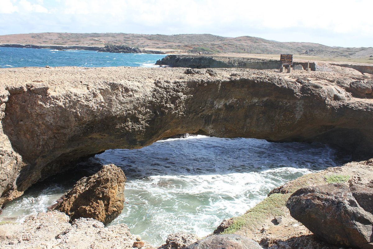
I don’t want to scare anyone off — thousands of people visit safely every week — but this is the one section I’d ask you to actually read, because the north shore has a deserved reputation and people do get hurt here every year. The combination of slick rock, sudden gusts, unfenced drops, and powerful surf is unforgiving in a way the calm west-coast beaches never prepare you for.
- Do not climb on the collapsed rubble or onto the arches. The rock is brittle, salt-weakened, and often wet. This is the single most important rule here.
- Never swim, wade, or “just dip your feet.” The surf and currents on this coast are deadly; there are no lifeguards and rescue is difficult. People have drowned. Admire the water, stay back from it.
- Mind rogue waves. Sets are irregular and a larger swell can surge much higher up the rock than the previous ten. Never turn your back to the sea at the water’s edge.
- Wear real shoes. The ground is rocky and uneven — closed-toe sneakers or sturdy sandals, not flip-flops.
- Watch children closely and constantly. The drops are sheer and unfenced. Hold little hands.
- Respect the wind. Hats, phones, and loose items go airborne; brace yourself on the exposed upper levels of Bushiribana.
- Sun and water. There’s little shade and a stiff breeze that hides how hard the sun is hitting you. Hat, reef-safe sunscreen, water.
None of this should keep a careful visitor away. Treat the place with the respect a wild coast deserves and it’s perfectly enjoyable — for more on this and other island gotchas, our Aruba travel tips guide is worth a look before you head out.
Photographing the Natural Bridge and Baby Bridge
This is one of the most photogenic spots on Aruba precisely because it’s so wild, and a little planning turns a snapshot into a keeper.
- Go early. Morning light rakes across the limestone and turns it warm and golden, the crowds are thin, and the wind is usually (a little) calmer. Late afternoon works too as the light softens.
- Shoot the Baby Bridge low and close. Crouch and frame the arch against the surf behind it; including a person gives a sense of scale.
- Use the waves. A slightly slower shutter blurs the spray into drama; a fast one freezes an exploding swell mid-burst. Either is great — just protect your gear from salt mist.
- Frame Bushiribana against the sea. The ruined walls with navy water and white surf behind them are the signature north-coast shot.
- Mind the salt and dust. Bring a lens cloth; the air out here is full of both. A phone in a case is genuinely the easiest tool in this wind.
- Stay safe for the shot. No photo is worth stepping onto wet rock at the water’s edge. The best angles are all from solid, set-back ground anyway.
Make a morning of it: nearby north-coast stops
The single best way to experience the Natural Bridge is to stop treating it as a destination and start treating it as one bead on a string. Everything below is within a short drive, and together they make a brilliant half-day self-drive loop. Here’s how I’d think about each.
Bushiribana Gold Mill ruins
Covered above, but it bears repeating because it’s so close: two minutes from the bridge, free, full of atmosphere and history, with the best coastal views of the loop from atop its walls. If you do nothing else beyond the bridge, do this.
Andicuri Beach & Black Stone Beach
Just inland and along the coast from the bridge is Andicuri, a dramatic, undeveloped windward bay framed by cliffs — a favorite of experienced bodyboarders and a gorgeous, wild place to stand and watch the swell (not a calm swimming beach; the same north-coast cautions apply). Reaching it usually means a bumpy track, so it’s an SUV-friendly add-on. Further along the wild shoreline, Black Stone Beach (Boca Keto) is a striking cove of smooth black volcanic stones rather than sand, and is home to a rare “tripod” natural bridge — a reward for those willing to bounce down a rough 4×4 trail to find it. Both are about scenery and raw coast, not sunbathing.
Alto Vista Chapel
A short drive west brings you to the bright-yellow Alto Vista Chapel, the “Pilgrims’ Church” that marks the site of Aruba’s first Catholic chapel, originally built in 1750. It sits alone on a rise above the north coast, reached by a winding road lined with white crosses, and it’s a serene, photogenic counterpoint to the raw drama of the bridge. The contrast — windswept ruin, then peaceful little chapel — makes them a natural pair on the same loop.
The Natural Pool (Conchi)
If the bridge is the headline, the Natural Pool — known locally as Conchi or “Cura di Tortuga” — is the prize for the adventurous. It’s a sheltered circle of calm water enclosed by volcanic rock right where the wild surf pounds, sitting inside Arikok National Park on this same coast. The catch: reaching it genuinely requires a 4×4 over a rough, sometimes washed-out track (roughly 45-60 minutes of slow going), a guided UTV/horseback tour, or a hike of a couple of miles. There’s also a park entrance fee (around US$22 per person as of late 2025, with kids under 17 typically free). It’s not a casual add-on to the bridge, but if you’ve rented a 4×4 for the day, the two pair beautifully into one big north-coast adventure.
California Lighthouse
At the island’s northwestern tip, the California Lighthouse is an easy, paved-road stop with panoramic views over the dunes and both coastlines — a gentle, family-friendly bookend if your loop swings back along the west side toward the hotels.
For where these stops fall in a broader plan, our Aruba itinerary guide sketches a full north-coast day, and if you’re timing your trip around weather and crowds, the best time to visit Aruba covers the dry, breezy season that makes these dusty roads easiest.
Is the Natural Bridge worth it for you?
Let me be candid, because “is it worth it now that it collapsed?” is the question everyone’s really asking.
- First-time visitors: Yes. It’s a quintessential slice of the “other Aruba,” it’s free, and it pairs with enough nearby sights to justify the drive. Just arrive knowing the big arch is gone.
- Cruise-day visitors: Yes, if you’re doing an island tour anyway — it’s a standard, worthwhile stop. If you’ve only got a few hours and want beach time, you might prioritize the west coast instead.
- Families with kids: Yes, with supervision. Kids love the crashing waves and clambering ruins; the unfenced drops mean hands-on parenting. See our Aruba with kids guide for more family-friendly planning.
- Couples: A dramatic, windswept, free morning out — pair it with the Alto Vista Chapel and a west-coast sunset later. Our Aruba honeymoon guide has more romantic itinerary ideas.
- Photographers and history buffs: Absolutely yes — arguably the best stop on the island for both, between the geology and the gold-mill ruins.
- Pure beach-and-relax travelers: Be honest with yourself. If you want calm turquoise water and a lounge chair, this isn’t that. It’s a scenery-and-history stop, not a swim.
Wondering where to base yourself for easy access to day trips like this, or what a day out here adds to the budget? Our guides to where to stay in Aruba and Aruba vacation cost both help, and after a dusty morning you’ll have earned a good meal — our Aruba restaurants guide has you covered.
Natural Bridge Aruba FAQ
Does the Natural Bridge in Aruba still exist?
The original, famous arch does not — it collapsed into the sea on 2 September 2005, leaving a field of limestone rubble. However, the site itself is very much still a popular, free attraction, and the smaller intact “Baby Bridge” stands right beside the original’s remains. So you can still see a genuine natural bridge here; just not the giant one from the old postcards.
When did the Aruba Natural Bridge collapse?
It collapsed on 2 September 2005. There was no single storm or dramatic event behind it; centuries of pounding surf and trade winds had steadily undercut the soft coral limestone until the span finally gave way. At about 25 feet high and 100 feet long, it had been one of the largest natural sea bridges in the world.
What is the Baby Bridge in Aruba?
The Baby Bridge (or Baby Natural Bridge) is a smaller limestone arch that sits a few steps from the original Natural Bridge’s remains. It was carved by the same wave action and is the bridge you can actually still walk up to and photograph today. Because it’s at human scale, it’s a wonderful close-up look at how Aruba’s sea arches form — many visitors find it the highlight.
Is the Aruba Natural Bridge free to visit?
Yes. Visiting the Natural Bridge site and the Baby Bridge is free, and so is parking in the on-site dirt lot. The adjacent Bushiribana Gold Mill ruins are free to explore too. The only costs are small ones at the gift shop — drinks, snacks, souvenirs, and a coin or two for the restroom. (The separate Natural Pool inside Arikok National Park does have a park entrance fee.)
Do you need a 4×4 to get to the Natural Bridge?
Not strictly. The final stretch to the bridge and Bushiribana is graded dirt, and plenty of people reach it in an ordinary 2WD rental by driving slowly and carefully. That said, an SUV or 4×4 is more comfortable and is genuinely necessary if you also want to tackle the Natural Pool or the rougher tracks to Andicuri and Black Stone Beach. Check whether your rental contract allows unpaved roads.
How long do you need at the Natural Bridge?
Budget about 30 to 45 minutes for the bridge and Baby Bridge themselves, or an hour-plus if you also explore the Bushiribana ruins and linger for photos. If you turn it into a north-coast loop with the Alto Vista Chapel, Andicuri, and the California Lighthouse, set aside a half day. The Natural Pool, if added, makes it a full-day adventure.
Can you swim at the Natural Bridge?
No — please don’t. The north (windward) coast here has powerful surf, strong currents, and no lifeguards, and people have drowned along this shoreline. It’s strictly a place to admire the waves from solid ground, not to swim or wade. If you want to swim near a rock formation on this coast, the sheltered Natural Pool (Conchi) inside Arikok is the safe option, conditions permitting.
What else is near the Natural Bridge?
Quite a lot, which is why it’s worth the trip. Right next door are the Bushiribana Gold Mill ruins. Nearby you’ll also find Andicuri Beach and Black Stone Beach (with its own tripod bridge), the historic Alto Vista Chapel, the Natural Pool inside Arikok National Park, and the California Lighthouse toward the northwest tip. Together they make an excellent self-drive or guided north-coast loop.
What are the Bushiribana ruins?
They’re the stone shell of a gold smelter built in 1872, during Aruba’s 19th-century gold rush, on the cliff right beside the Natural Bridge. The mill processed locally mined ore, harnessing the strong coastal wind, before closing in 1899. You can walk the open walls and climb a surviving staircase for sweeping coastal views — all for free. It’s one of the most atmospheric historic sites on the island.
Final thoughts
I’ll be honest: the first time I stood where the Natural Bridge used to be, I felt a flicker of disappointment. But it passed fast, because the place delivers something better than a single photo-op. You get a wild, wind-hammered coast that feels nothing like the resort strip, a still-standing little arch you can walk right up to, a genuinely fascinating gold-mill ruin next door, and a jumping-off point for the best self-drive morning on the island. It’s free, it’s quintessentially Aruban, and it tells you more about how this island was actually made — by wind, water, and a brief, stubborn gold rush — than any beach ever could.
Go early, wear real shoes, keep well back from the surf, and treat the collapse not as a letdown but as the island showing you geology in motion. Then point the car west toward the chapel and the lighthouse, and let the north coast do the rest. For the bigger picture of how this fits your trip, head back to our complete guide to things to do in Aruba — the Natural Bridge is one of its most rewarding chapters.
Sources & further reading
- Aruba Tourism Authority — Aruba’s Natural Bridges
- Aruba Tourism Authority — Bushiribana Gold Mill Ruins
- Wikipedia — Aruba Natural Bridge (collapse date, dimensions)
- Wikipedia — Bushiribana and Balashi (gold-mill history)
About the author
The ArubaTourism.org team writes practical, been-there guides to every corner of the One Happy Island — from the resort strip to the wild north coast. We cross-check details against the Aruba Tourism Authority and local sources, drive the roads ourselves, and update our guides as conditions change. Hours, prices, and road conditions shift; always confirm time-sensitive specifics locally before you set out. Last updated June 2026.
North coast limestone arch by We El (Public domain).